|
|
||||||||||||
 |
 |
|
Wolcott Historical Society News - April 2023 By Florence Goodman I love to receive new information about local history that I have researched and shared with residents. I recently received and interesting email from Rich Mailly after last month's series on small planes that had gone down in our town over the years. Rich remembers a minor plane crash sometime in the mid 1960's (65/66) that happened on the east side of Alcott Road about 2/3's of the way up before it meets Spindle Hill Road. He remembers seeing the article in the Waterbury paper and thinks that the pilot's last name was Ciccio; no one was hurt. He said that by the time he was able to get over there to see it they had already removed the plane on a flatbed truck. Rich also remembers seeing the bent tail section but is not sure if he saw it when his parents drove them by the site after church (it was a Sunday) to look at it or if it was a photo in the newspaper. He stated too that later in the afternoon their family visited friends on Alcott Road and when he wanted to walk up to see it he was told they had already taken it away. If I'm not mistaken the property where the plane went down would have been owned by the Churchelow family. I have not tried to find the old newspaper article, but I will at some point. If anyone remembers this crash, I'd love to hear from you as well.
This September the Wolcott Congregational Church will be celebrating its 250th Anniversary so this month I'd like to share some church history with you. Originally the church was referred to as "The Meeting House atop of Benson's Hill." It was on November 18, 1773, that thirty members of the Farmingbury Society signed the "Covenant of Confederation" which gave birth to this Parish Church. At that time Connecticut was a colony under the rule of King George III of Great Britain and our town boundaries were divided between Farmington and Waterbury. The north-south highway that acted as a dividing line between the towns was "Olde Bounde Line." The land east of the highway was in Farmington and the land west was in Waterbury.
Joseph Atkins who served on the Meeting House site committee granted two-acres of land for the church on June 8, 1772; one acre on each side of Bound Line Road. It was his intent that one be used for a Green for the church and one for the building. Mr. John Washburne, a past town historian was very interested in the location of the first church in relation to Center Street and Bound Line Road. After much research he was able to find that the first church structure (that burned) was located exactly where todays Center Street and Bound Line Road intersection separate in front of Beecher Memorial.
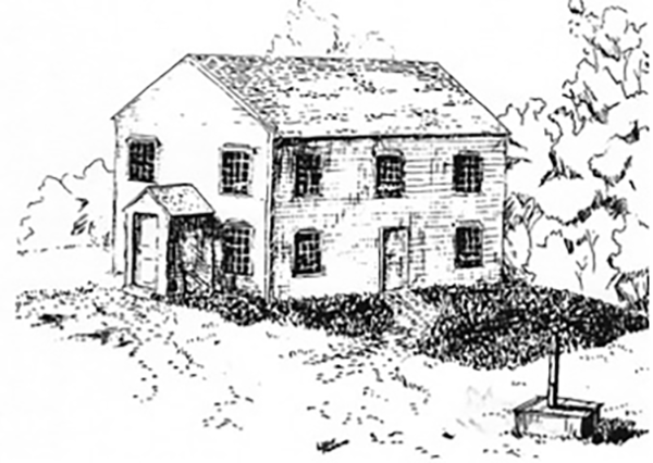
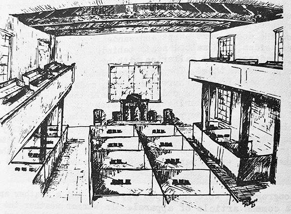
The "Original Meeting House" was built in 1772/73 and Abraham Wooster was hired as the master carpenter who was paid by the day. It was voted that the building should be 48 feet long and 36 feet wide and the height left to the carpenter. "The building was to be boarded and clapboarded with drent oak and shingled with chestnut." The siding was painted white, and the roof was painted red. The members of the Society donated most of the lumber, materials, and labor. The following explanation on how the townspeople helped build the church is from Mr. Washburne's booklet, "The Meeting House Atop of Benson's Hill." "Though detailed record is lacking, it may be assumed by customs of the day that the raising of our Meeting House was indeed a great event. Farmingbury men came from miles around with tools including pike poles, pitch forks and crow bars. A dram of rum gave sudden surge of strength for the upcoming days labor. The pikes and forks lifted framing members and broadside into the air while men with the bars firmly braced the corner posts as they slid them gently into the mortices cut in sills. After a hard day's work, the refreshment committee would provide a generous supply of food and drink to all hands including workmen and on-lookers alike. More oft than not, a grand dance and otherwise celebration would be the order of the day. Farmingbury was no exception as it should be noted that no less than eight parishioners were named and voted to sell 'likers and vitels' ... When the meeting house was fully framed and raised it was said that all parishioners could sit on the sills. A sketch of the plot in the Society's original book shows that the house stood on the dividing line of both towns, (middle of Bound Line Highway) on the north side of the Green facing southward towards the Green. The principal door was in the front with two side doors in the east and west ends. The floor was laid and stairs at either side led to an unfloored gallery. Money in those days was in short supply as evidenced by the simple unfinished way the house remained for several years without pews, stationary seats, or a permanent pulpit. A church bell was a luxury that also had to be omitted but a lusty beat of a great bass drum served well the purpose to summon the faithful."
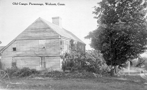
Reverend Alexander Gillet was secured as a probationary preacher and it was voted in August of 1773 that he continue his probation; he was officially ordained the first preacher on December 29, 1773. During his eighteen years of service much of the interior of the church was completed and 99 new members were added to the role. He completed his service in November of 1791. The original parsonage where Reverend Gillet lived was at the corner of Bound Line Road and Orchard Lane. And so, the original structure of the Wolcott Congregational Church was completed in 1773 and served the people for about 66 years until a fire destroyed it.
(Information for this article was taken from "The History of Wolcott, Connecticut from 1731 to 1874" by Reverend Samuel Orcutt, "The Meeting House Atop of Benson's Hill" by John Washburne, and "The Wolcott Congregational Church 1773-1948" by Rose E. Wakelee)
A sketch of the "Original Meeting House" by Lisle Fleming. The church was 48 feet long and 36 feet wide and built in 1772-73. Joseph Atkins gave the two-acre site for the building on June 8, 1772. It was destroyed by fire in 1839.
An etching by Lisle Fleming of the inside of the Meeting House, which was full on Sundays. The singers sat in the gallery, nearly filling the front seats on three sides. The ladies were able to remove their bonnets for singing.
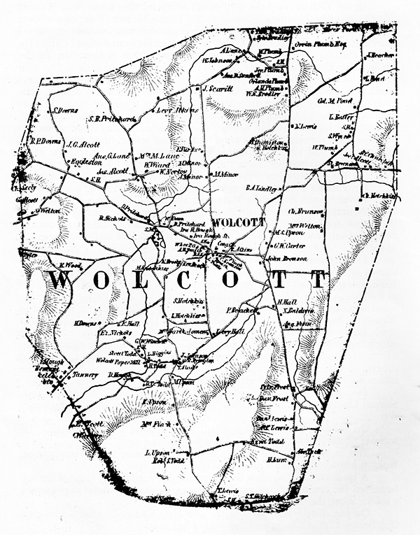
An 1840 Wolcott map.
The dwelling place of Reverend Gillet was located on Bound Line Road at the intersection of Orchard Lane. The structure no longer stands, but the old well pump is still found there today.
To view past installments of the Historical Society News, click here. |
|
|
[Home]
[News]
[Purpose]
[Calendar]
[Museum]
[Membership]
[History]
[Contacts]
[Links]
All material at Wolcott Historical Society Web sites Copyright © 2000-2023 Wolcott Historical Society |


